More Recent Sprawl Analyses
Since the NLCD data in the study cited below are a little old as Brian mentions below (not that that invalidates the data of course, particularly for time series analysis), here are some references to more recent studies:
Yang, Xiaojun "Satellite Monitoring of Urban Spatial Growth in the Atlanta Metropolitan Area" Photogrammetric Engineering and Remote Sensing, 2002, 68(7). Uses data from 1973-1999 (Thematic Mapper/Landsat).
Yang, X. and Lo, C.P. "Modelling Urban Growth and Landscape Changes in the Atlanta Metropolitan Area" Int. J. Geog. Inf. Sci. 17(5): 463-488.
Finally, newer NLCD data actually are becoming available here (2002). Comparison of NLCD and Landscan data:
NLCD 2001 on left, Landscan on right. Approx. same scale but not exactly (and on diff. projections I believe).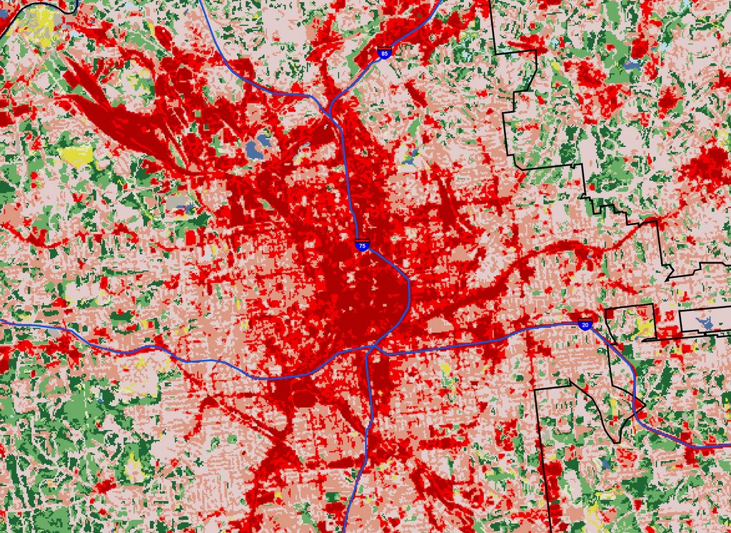 Detail of downtown Atlanta. Red indicates urban areas I believe. City of Atlanta boundary shown in black. Original resolution is 30m square.
![]()
1 comment:
if you're interested in land use monitoring and modelling urban growth scenarios you should check the gmes geoland (observatory for spatial planning) project. they are doing some great work on that topic.
Post a Comment