10.31.2005

Tracking chips in passports

In his recent book Spying with Maps Mark Monmonier asks if our locational privacy is worth protecting. He documented a number of ways we are under "geosurveillance."

Now comes news that the US government will implement RFID chips in our passports, despite a public comment response that was 98.5% negative. These chips emit a radio signal that carries information about the bearer (just what information is not clear) and the signal can be detected at a distance. Why bother having a public commentary if you just ignore it.

Two possibilities are that the passports will provide tracking information as well as biometric data. Is this really what we want in our own passports? Geotracking information? The problem with these "solutions" is that it makes a suspect of us all. We're all potentially dangerous.

The system, which will be implemented for government employees next month, will start for all Americans in about a year. Not to mention that many visitors from overseas will also be required to have chips in their passports. Just how will that happen? I can't imagine the Netherlands or Germany implementing this (though Blair might).

What is the real reason people actually want this, I wonder.

10.30.2005

An historic picture


A very historic picture: the headlines after Libby was indicted. I like the contrast between the tabloids and the WSJ. Almost like the WSJ is too embarrassed to report when one of their own is brought down.

10.25.2005

Old and New Models of Mapping

I'm not sure this works directly, but is it possible to make a table of contrasts between the old and new models of mapping/cartography?

By directly, I mean a 1-1 replacement of the old with the new. There might be more than one alternative.

Old: New

Experts: Users

Closed source/monosource: Open source

Cartographers: Non-cartographers (artists, map hackers)

Communication: Participation

Maps are neutral: Maps are power-knowledge

Non-political : Political

Desktop PC: the network

Update: Nov. 6 2005. How does Web 2.0 relate here? There's an article on this in the format I started here. This is by Tim O'Reilly.

10.23.2005

Google Earth and satellites?

Here's a challenge for the Google Earth champions: incorporate live satellite tracking.

There are all sorts of Google Earth applications which show features on the earth's surface, but none which show the hundreds (thousands?) of satellites in earth orbit. Why not?

How difficult would it be to set something up so that we could represent the satellites, see the different rings of satellites (near earth orbit, geostationary, GPS etc.)?

Something like this.

Further data might be provided:

...a picture of the satellite when you clicked on it
...speed of satellite
...launch data (who launched it when, with what rocket)
...who uses it, for what purpose
...as with the NASA application above, show the ground track, zoom in, out

Obviously some of this data is proprietry, but I think it would also be nice to know just how much we don't know about these objects..

10.21.2005

Report on NACIS from John

Here's John's report on NACIS XXV.

10.20.2005

NYT, better late than never

The NYT (under fire for its poor journalism these days) has one of those "oh I see" articles on map hacking.

Article here (for now).

10.18.2005

NACIS pictures

I've set up a whole bunch of NACIS pictures over at a Flickr account.

Click the "NACIS" set for a selection of pictures or just go through all pictures.

10.13.2005

NACIS picture blogging


View from hotel over construction next door.


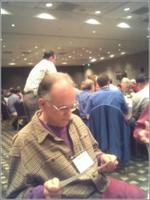
Denis Wood studies the program....


Scott eats his sausage and bacon. Jim in background.


View from in front of the hotel, the temple I think.


John asks me not to take his picture

10.11.2005

ESRI vs. rest of world XI

Link to GIS User here about prices

Map thefts

Updates on the Smiley case are provided by Jonathan Crowe at the Map Room.

Also, there is an article in this week's New Yorker (posted here because his comments section appears to be down).;

10.07.2005

This is an interesting observation (via spatially adjusted).

Does a map constrain your interaction with the world? That is, if you were in a place, would you look around yourself more, and notice things for what they are more, if you didn't have a map? Do maps just create concerns about exactly where you are and where to go next? And does it really matter? Put another way, does a map affect your being in the world (Heidegger language for those keeping score).

I think your answers to this will depend on what your understanding of maps is. If you believe maps are an "interface" or "mirror" on the world, and are therefore secondary to the primary reality of brute fact, then I'd bet you do think this matters (and wouldn't you probably have Heidegger on your side?).

If on the other hand you think maps are creative stories we tell about ourselves and not degraded versions of reality then we need more maps that are more creative (like the maps in the You Are Here book by Katherine Harmon).

10.05.2005

NACIS blogging

Next week I'm off to NACIS, one of the best cartography conferences on the calendar. NACIS could probably fit in one of the cafes at the ESRI user conference, which is why I like it so much. It's extremely intimate, maybe a couple of hundred lucky people gathering, this time, in Salt Lake City. And I also like it because of the diversity, it's great to meet mapmakers and people whose passion is mapping and not just damn academics all the time. (David Rumsey is giving the closing speech.)

Apparently the hotel has free wireless so maybe I'll be able to do a bit of picture blogging from there. I'll be staying on a day to do Bryce Canyon.

10.04.2005

ESRI is ridiculous

After Jonathan Crowe mentioned that ArcReader 9.1 can display true 3D text on ArcGlobe and thus avoid having to acquire ArcGIS to view these maps, which are competitors to Google Earth, I went and checked the system requirements for ArcReader.

Check it out:

Hardware Requirements

CPU Speed:

800 MHz minimum recommended or higher

Processor:

Intel Pentium or Intel Xeon Processors

Memory/RAM:

For viewing 2D map documents:
- 256 MB minimum, 512 MB recommended

For viewing 3D globe documents:
- 512 MB minimum, 1 GB recommended

Disk Space Requirements:

- In addition, up to 50 MB of disk space maybe needed in the Windows System directory (typically C:\Windows\System32). You can view the disk space requirement for each of the 9.1 components in the Setup program.

Notes:

Internet Explorer 6.0 Requirement:
- Some features of ArcReader require a minimum installation of Microsoft Internet Explorer Version 6.0. If you do not have an installation of Microsoft Internet Explorer Version 6.0 or higher, you must obtain and install it prior to installing ArcReader.
- Installation on an NTFS (New Technology File System) drive is strongly recommended.

Additional Requirements with ArcReader:
- CPU Speed: 1.5 GHz recommended or higher.
- ArcReader will create cache files when used, additional disk space may be required for this and any other 3D data used.
- Video Card: An OpenGL 1.1 or above compliant video card is required, with at least 32 MB of video memory, however 64 MB of video memory is recommended.

Printer Support:
ArcReader supports printing to any Microsoft certified Windows printer using the native driver in ArcGIS. Please note that some printer drivers do not support complex maps and the ArcPress printer driver or additional hardware may be needed for these complex maps.

ESRI recommends the following configuration when printing large maps with the ArcPress printer drivers:
- Pagefile system size of 4096 Kb is recommended. ArcPress depends on being able to acquire potentially large contiguous blocks of memory to process a map. The windows limit is 2048 Kb and byhaving a pagefile.sys file of at least twice that size helps ensure that other applications running and using the pagefile system will not introduce an unexpected limit for the ArcPress printer driver.
- Pagefile system should be stored on a dedicated partition or, if possible, a dedicated drive. This will prevent the file from becoming fragmented and diminishing ArcPress’s ability to acquire contiguous blocks of memory.
- If large complex maps do not print, then reboot the computer to ensure the pagefile system is cleared. If the pagefile system is not a dedicated drive or partition, make sure that drive does not need to be defragmented.
- Disk Space: at lease 10 GB of space is free on the drive where %TEMP% is located, as potentially large temporary files will be written there while ArcPress is processing a map for printing
So basically you're telling me I need 1 gig of RAM, 10 gig of disk space, 1.5 gig of chip speed, and oh yes, a "dedicated partition" for printing??

So this kind of power is possessed by what, 0.00001% of the world's population? I have a fairly new laptop, and it has 800mHz chipspeed and half a gig or RAM and I think that's way powerful. Can I run ArcReader? No.