New online GIS of medieval towns
A team at Queen's University, Belfast has released an online GIS of several medieval towns based on archaeological fieldwork:
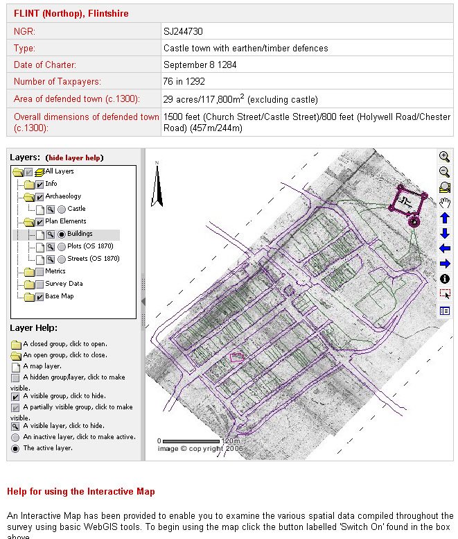
Using mapping as a medium, the project examined how urban landscapes were shaped in the middle ages, the project furthers an understanding of the forms and formation of medieval towns. It is the first project to have used spatial technologies – Geographical Information Systems (GIS) and Global Positioning Systems (GPS) – as a basis for mapping and analysing medieval urban landscapes...This project combines several of my favorite things, including the overlaying of historic maps in GIS (a la the David Rumsey site) and the characterization of urban areas in terms of its population. You can also download historic data files in shapefile format for offline analysis.
The project focused on a group of ‘new towns’ situated in Wales and England and established in the reign of King Edward I. The towns were all founded between 1277 and 1303. The project looked at thirteen of them in detail: Aberystwyth, Beaumaris, Caernarfon, Caerwys, Conwy, Cricieth, Flint, Harlech, Holt, Newborough, Overton, Rhuddlan, and Winchelsea.
Via the History of Geography listserv
![]()
3 comments:
Do you have a link to the Queen's University, Belfast GIS of medieval towns?
Thanks!
Yes, sorry it is:
http://ads.ahds.ac.uk/catalogue/specColl/atlas_ahrb_2005/
leisure petrussel alliancesm laptop vels heading tosun removal sanctions eventually possesses
semelokertes marchimundui
Post a Comment