Hurricane maps from Weather Underground
One of the other comments to the piece on science mentioned in the previous entry was on the maps produced by Weather Underground.
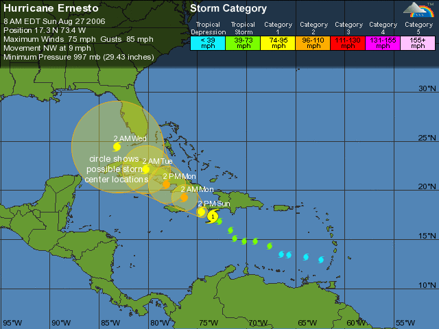
The map shows the current location and strength of tropical storms and hurricanes, as well as the predicted location over the next few days. A circle of increasing diameter shows where the storm might go.
Strength is shown using different colors. Other features include a map showing all the storms since 1851 that passed within 300 miles of the current storm (Ernesto, this season's first hurricane) and where they went: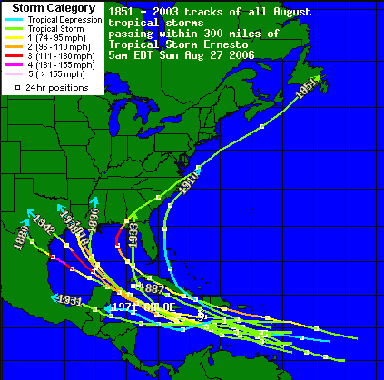
As everyone probably knows by now, this is the one-year anniversary of hurricane Katrina. We had a significant number of refugees from New Orleans come to Georgia and the Atlanta metro area last year. I wonder how they are doing.
![]()
No comments:
Post a Comment