County level map, 2004
Usually for voting results you see statewide maps. These are useful in a presidential election because of the electoral college. they are less useful for getting a more detailed view of voters' preferences. Unfortunately data at the county level are not usually free.
However, I recently found some great county level data from Anthony Robinson which has voting data like the following: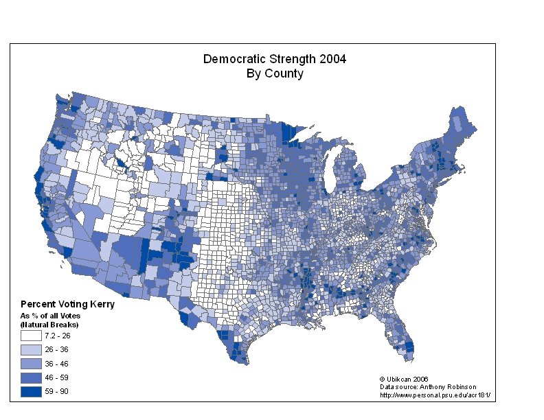
I think it makes a very interesting map. You could do the same for a Bush strength map as well.
![]()
4 comments:
You can get lots of precinct-level maps here:
http://www.fairdata2000.com/VoterRegistration/
...mostly from the 2000 and 2002 elections. Bush-Kerry is mapped for California, Minnesota, South Carolina, and Wisconsin at the precinct level.
Bill
Hey that is a great set of data!
I fooled around with it a bit myself and ended up with this little web application:
http://showcase.sharpgis.net/counties.aspx
Glad everyone is finding interesting uses for this data set. It was my great hope when I posted it that others would be happy to re-use the free data for all kinds of other purposes. I created it in a tiny fit of protest against the notion of needing to PAY for geospatial election results for the country I live in! Also, I was intrigued at the possibilities of coupling the socioeconomic covariates we use to study cancer epidemiology with some of the election results, since people so often toss around generalizations about the types of people who vote for A vs. B and things like that.
Cheers,
-Anthony Robinson
viagra sample viagra rrp australia what is generic viagra viagra rrp australia purchase viagra low cost viagra buying viagra in uk sublingual viagra viagra lawyers viagra over the counter viagra online uk viagra australia cheap herbal viagra how viagra works
Post a Comment